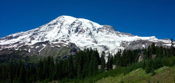
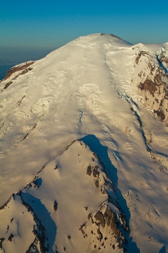
Pushing 4,392 meters into the cloud-friendly skies of the Pacific Northwest, Mt. Rainier is a common sight throughout Western Washington. From community to community it dominates the skyline. This massive stratovolcano is the perfect backdrop for enchanting photographs and picture-perfect postcards, at times discernible from as far away as Victoria, British Columbia, and Corvallis, Oregon.
Rainier needs little introduction as it is the largest mountain in both the Cascade Range and the state of Washington. Known locally by the name “Tahoma,” or “Tacoma,” the composition and structure of this behemoth is fascinating. Two massive craters sit at the top, the rims of which are snow and ice free thanks to geothermal heat, and include a glacier cave of remarkable proportion – the largest in the world.
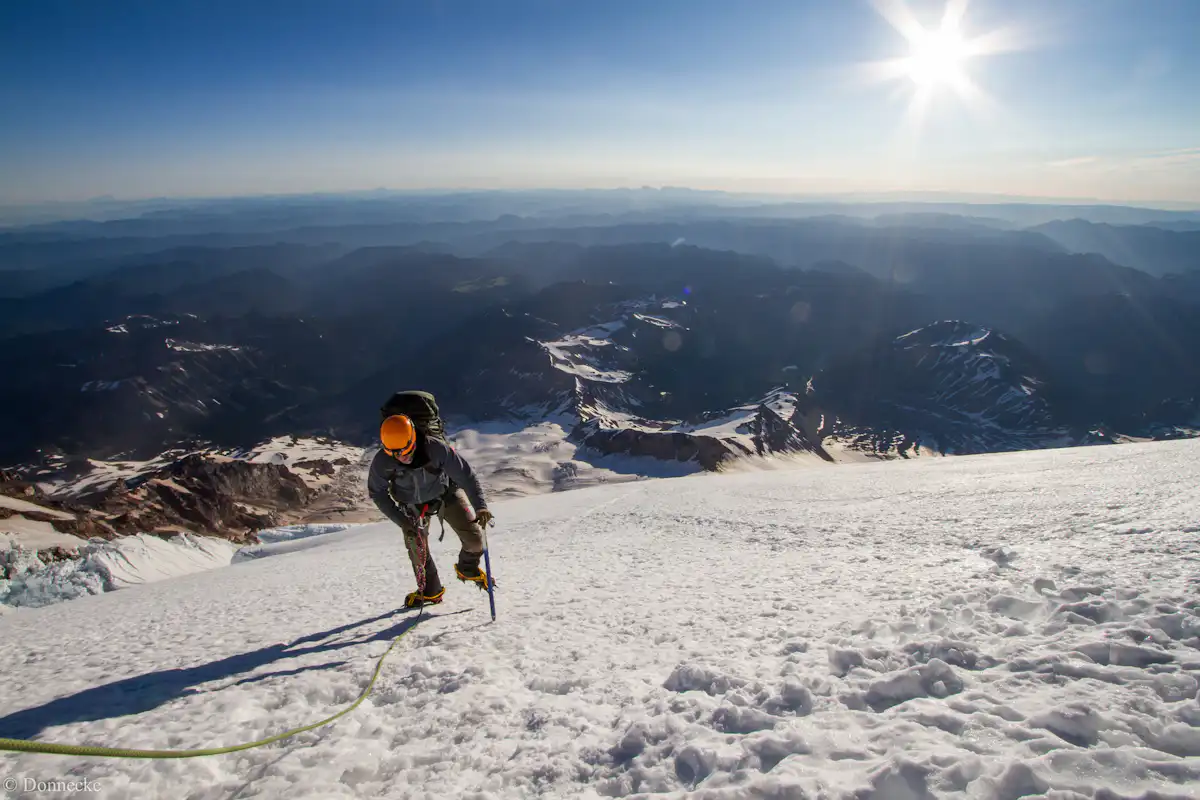
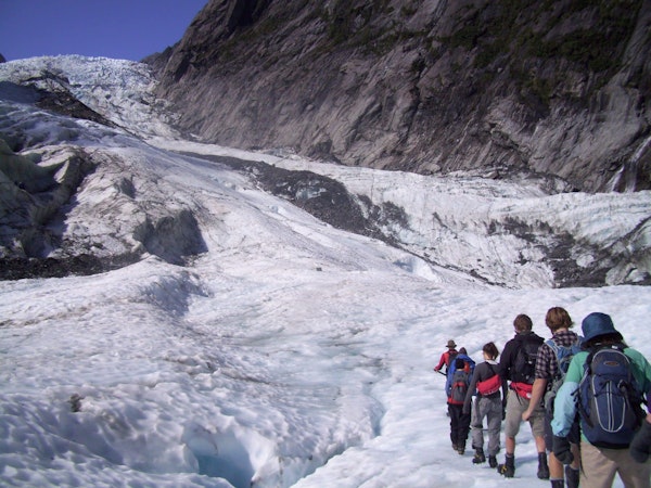
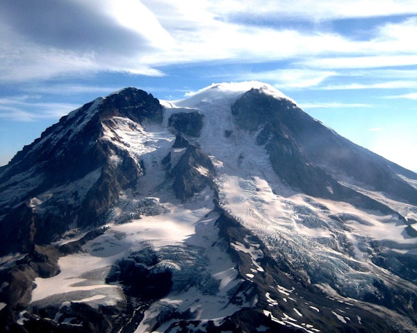
The most intriguing feature of Rainier is probably its glaciers. With 26 major glaciers and a few snow fields to match, the technical challenges (big and small) will develop even the most seasoned alpinist and sharpen their talents for the future. Mt. Rainier is a perfect summit for those who are looking to get onto the biggest peaks in the world, including Everest.
Even though this fascinating volcano has a stark prominence greater than K2, and even though its character is closely aligned with the staggering elevation gains in the Chugach and Andes, there are ample opportunities for all levels of proficient mountaineer to find their way.
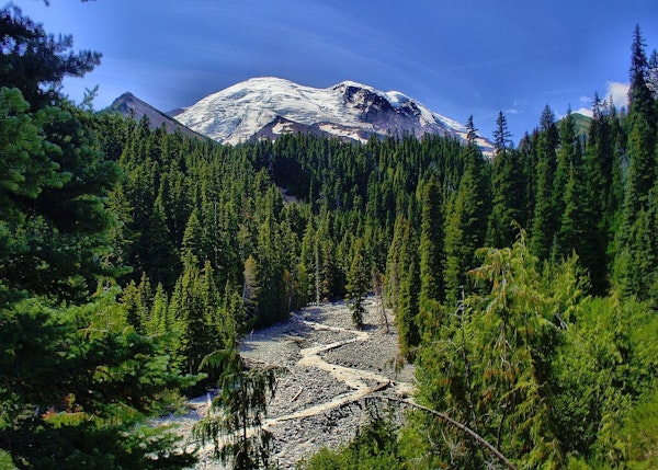
Rainier may seem pretty daunting – after all, it has a prominence of over 4,000 meters. But this mountain is a symbol of the Pacific Northwest and ingrained in its identity. For Washingtonians, this is the climb that will define their career as mountaineers and a source of pride for the regional beauty of the Evergreen State.
For mountaineers, Rainier has cultivated a cautious appreciation and general excitement towards its ascent. AMGA-certified Mick Pearson and the qualified guides of KAF Adventures know this mountain by heart and have been leading their own brand of Rainier programs, as well as worldwide expeditions, since 2006.
“This is our largest glaciated mountain in the Lower 48 states and a serious and thrilling endeavor,” says Erika Klimecky, Managing Director of KAF Adventures.
Pearson and his team are gearing up for a special summer ascending Rainier. They are offering a four-day mountaineering program in coordination with the Washington Trails Association (WTA) up Mt. Rainier via the Emmons Glacier Route or the Disappointment Cleaver Route.
This program incorporates fundraising into a three-day Mt. Baker climb and a single day mountaineering course into its itinerary, proving just how much preparation and technical planning goes in the ascent of Mt. Rainier.
Where to Go to Climb Mt. Rainier? How to Get There?
This beautiful mountain can be found south-southwest of Seattle, roughly 59 miles (95 kilometers) away from the city. Sea-Tac International Airport is even closer, and a trip south on I-5 or the 167 will get you there within a couple of hours. The Pierce Country Airport at Thun Field is also a possible regional airport for quick access to the mountain.
If you want to approach Rainier from the west, enter via the 165 through Fairfax. To get to the Sunrise Visitor Center on the east side of Mt. Rainier National Park, you will follow the 410 around the north of the park through Greenwater. From the south, approach Rainier from the west and use the 706 to get to Longmire.
How Long Does It Take to Climb Mt. Rainier?
The preparation and planning required to tackle the obstacles of Rainier allow it multi-day summit time, but successful climbs are not always on the itinerary. Giving yourself two or three days to climb is reasonable, but many programs will take at least for days. With these schedules, building in an additional day for adverse weather can determine whether or not you are able to see the summit on a successful climb.
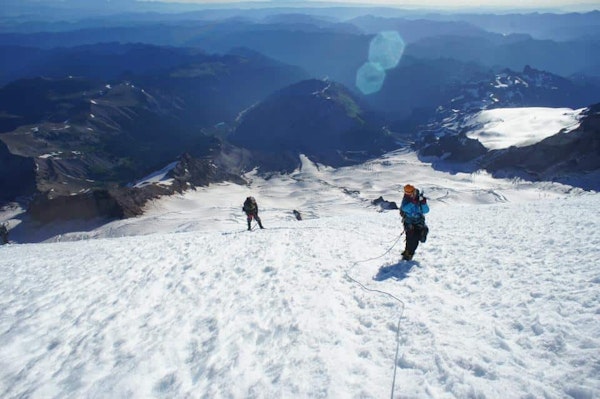
Klimecky has a four-day program with additional courses prepared to maximize success. “Our four day climb and the preceding courses will prepare climbers for their chance at the summit of this iconic mountain.”
What Are the Main Climbing Routes for Mt. Rainier?
There are a few different routes for climbing to the top of Mt. Rainier, but here are the three main routes of choice.
Disappointment Cleaver Route
Entering through the Nisqually Gate of the Mt. Rainier National Park, you will pay a fee and head to paradise (an additional 19 miles). The approach from Paradise to Camp Muir is pretty enduring. The Skyline Trail takes you 4,660 vertical feet in just over five miles. The actual ascent goes up to Cathedral Rocks Ridge and the Ingraham Glacier. A tricky and possibly treacherous traverse across Ingraham takes you to Disappointment Cleaver.
Head for the top of the Cleaver, which hits 12,300 feet, and climb to the craters. You will be on the east side and may need to head west, so be prepared. In all, this route covers about 15 miles and basic alpine climbing with glacier traversing and technical ascents. The glacier movement can make this a challenging expedition. Finish up by returning back the way you came.
This is the most popular route, and you reach nearly 9,000 vertical feet. It can get crowded during the summer, so bookending trips around the high season of June, July, and August might be your best bet at an enjoyable ascent.
Emmons Glacier Route
Another popular route, this course begins at the White River Entrance Station of Mt. Rainier National Park. Sign in for “climb” and away you go! A roughly four and a half mile hike will take you from White River Campground to Inter Glacier at 7,000 feet where you will gear up for the ascent.
Following the glacier 1,500 feet straight up the middle (demanding traverse), you will reach the rim at Camp Curtis before heading down onto Emmons Glacier. Camping at Steamboat Prow leaves you well-rested for an early-morning departure, which you will need for the upcoming heavily-crevassed climb. The route goes straight up and left, though you can also bear right and fight across the saddle to the true summit. Crossing to the west takes you to the peak at the edge of the crater. Once complete, turn around on the same route and follow it back down.
This route runs about 10,000 in vertical feet. It, too, is strenuous and boasts serious glacier maneuvers. Basic alpine and climbing skills are vital for a safe and successful trip. There are a few bits of technical work that can complicate the route, but overall it offers a look back through history and the remarkable mining activity on the mountain.
Liberty Ridge Route
This is a serious route reserved for the grizzled mountaineers. Maintaining focus throughout the climb is just as important as serious preparation in the months leading up to the expedition. The course begins along the Glacier Basin Trail. Make your way to Curtis Ridge from Carbon Glacier and St. Elmo’s Pass. Snow and rock climbing ensues, hitting 30 and 40 degrees up to Thumb Rock.
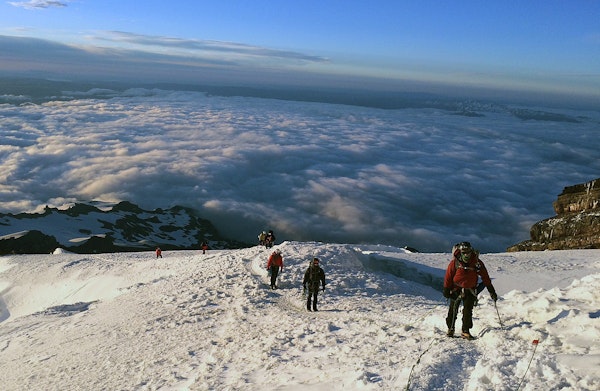
From here, an ice pitch takes you to steeper slopes and more mixed climbing. Once you reach the infamous Willis Wall (exposed and intimidating mixed climbing) and make it over, you will find yourself on the Liberty Cap Glacier just a few hundred feet from the summit. Exercise caution on the ice and move efficiently across the glacier. The ridge will slowly level off as you near the summit. You can return the way you came, or use the Emmons Glacier descent.
This climb exceeds 10,000 vertical feet, and is a solid Grade IV climb. The bergschrund at the top may be the most challenging (and fun!) portion of the climb, but there are other obstacles that deserve consideration. This is a phenomenal route for advanced climbers to prepare for the more problematic hazards of mega summits.
Join the certified guides at KAF Adventures for a 4-day guided ascent to Mt. Rainier by either the Disappointment Cleaver Route or the Emmons Glacier Route.
How Hard Is It to Climb Mt. Rainier?
Mt. Rainier is one of the more demanding climbs in the west. It is a healthy blend of mixed climbing, crevasse movement, glacier traversing, and exposed areas. A general physical fitness is required to partake in many of the Rainer programs. It is certainly necessary to feel safe and comfortable on the climb without compromising the integrity of the program for you or your group.
“Intermediate level climbers are usually prepared to attempt a summit of Rainier,” says Klimecky. “Special skills required include knowing how to use the equipment (ice axe, ropes, crampons) and know how to function on a rope team.”
She also went on to stress that crevasse rescue training is helpful, as well.
KAF Adventures admits to using Mt. Baker as a good “starter climb” for Rainier, which they do often to prepare mountaineers for their programs. “The technical difficulties vary, but include potential environmental hazards, tool use and training, altitude sickness and related personal barriers.” She also mentioned potential for team member rescue and the weather as possible challenges.
Physical preparation should include a fairly substantial work out plan. Cycling, running, and hiking for a few months before your expedition can do wonders for your health and make the ascent that much easier.
What Is the Best Time to Climb Mt. Rainier?
Climbing during the spring and summer are the best times, considering the temperature is more suitable at this time for a high altitude location. The volatile weather patterns around the mountain are also less dramatic from late April through September. The average temperature is at or above zero from May to October.
Heading to Mt. Rainier National Park in July and August can be especially striking, thanks to the wildflowers filling the meadows and valleys along its slopes. If you find yourself heading to the mountain in April and May, you might just be able to beat the crowds and get your hands on some of the sneaky good spring weather.
What Is the Weather Like On Mt. Rainier?
Just because you are embarking on a summer expedition does not mean you are free from inclement weather. Blizzards are common throughout the year, even in July and August. The further up you get onto the mountain, the more likely you will come across difficult weather patterns.
Moisture can linger in the air and cause uncomfortable programs during this time, though the most troubling feature of Mt. Rainier is the fickle nature of its worst weather. A pleasant day can turn for the worst in just a matter of hours, and mountaineers should plan accordingly to combat possible weather-induced interruptions to their itinerary.
What Equipment Do I Need to Climb Mt. Rainier?
Mountaineering equipment is essential to a safe and successful trip, so it is important to come prepared and heed any warnings or suggestions produced by your guide. The KAF Adventure team has provided a “short list” of items to bring on an expedition up Mt. Rainier (but certainly not limited to this list):
Helmet
Harness
Mountaineering boots
Glacier rig
Ice tools
Crampons
Sleeping bag and sleeping pad
Personal clothing suitable for winter and expected weather
Generally speaking, the required equipment can change from guide to guide, so get in touch with your respective leader and determine what gear is right for you. Guides usually make themselves available to answer any questions or to provide a more detailed list of gear upon booking.
“We love showing people that a challenge like climbing Mt. Rainier can be the experience of a lifetime, through teamwork, learning, and pushing your own limits!”
Has your interest been piqued? Book a Mt. Rainier mountaineering expedition NOW with the KAF Adventures Team and summit this glacier-packed volcano for the time of your life in the beautiful Pacific Northwest and Washington State!
Thanks again to Mick Pearson, Erika Klimecky, and the KAF Adventures Team for their help!
